A superintendent, an RFI that didn't get answered, and a wall that was about to be torn out over a question that didn't need a backhoe to answer.
This is what actually happened last week on one of our active Front Range sites, six months into a multi-flight mapping engagement. The superintendent had been on the job for a while. It was his first project with us. And he didn't yet know what the orthomosaic could do.
The Question on the Table
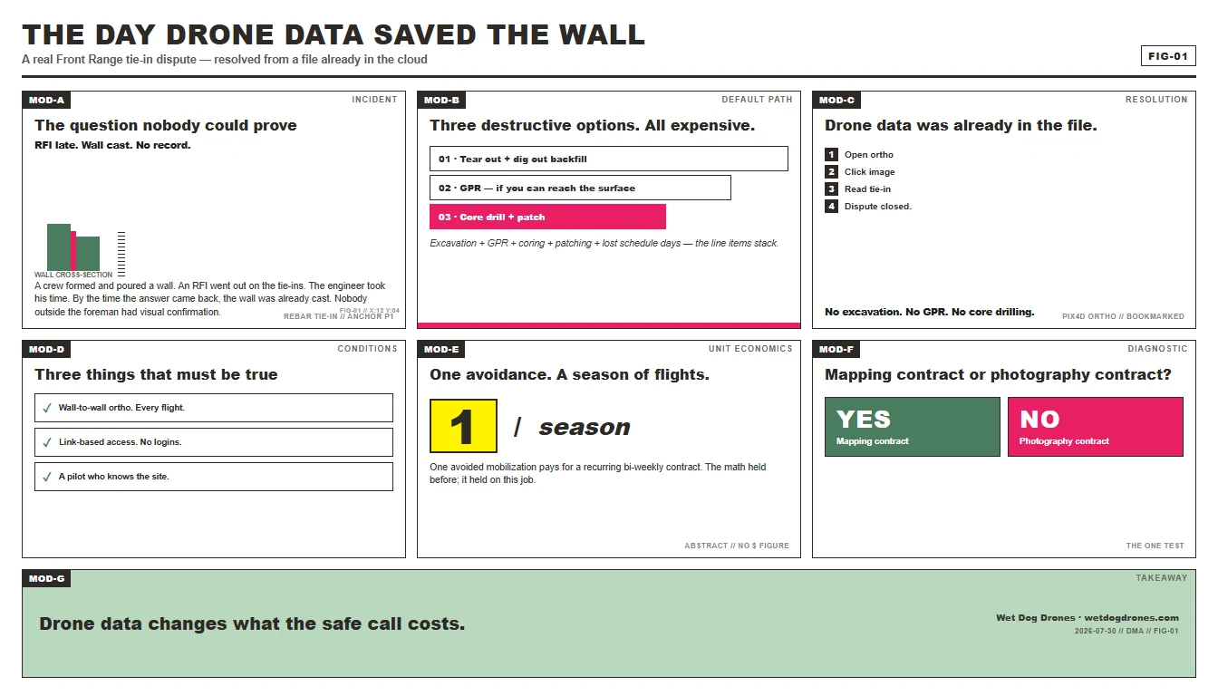
The crew had formed up and poured a concrete wall. Then an RFI went out on the rebar tie-ins — the splices where the horizontal and vertical reinforcement bars overlap inside the form. The engineer took his time responding. By the time the answer came back, the wall was already cast.
The answer the engineer eventually gave matched what the crew had already built. So far, so good — except nobody outside the foreman and the ironworkers had visually confirmed the tie-ins were in place. Nobody was going to bet a structural warranty on it.
The Default Path Is Expensive
When you can't prove what's inside a finished concrete wall, you have three options:
- Tear the wall out. GPR-style — but GPR for buried rebar works through the surface, not through the backfill. To inspect the back face of the wall they were already forming, the contractor would've had to dig out all the backfill on the other side first. Then come back and inspect.
- Run a Ground Penetrating Radar scan. GPR works, but it requires the surface to be accessible on the side you want to read. Half the time, in a formed-and-backfilled wall, the scan you actually need is on the side you can no longer reach without excavation.
- Order a destructive test. Core drill, chip out a section, look at the splice. Then you patch it and pray the patch matches the structural calcs.
None of those are small numbers. Excavation, GPR mobilization, coring, patching, lost schedule days — the line items stack fast on a wall that might be fine.
What the Drone Already Had
The day before the question blew up, we'd flown the site and processed an ortho. Everything was sitting in Pix4D Cloud — the standard deliverable, already shared with the superintendent, already in the system.
The superintendent didn't know he could use it to settle the dispute.
When the call came in, the answer was: open the ortho. Click into the image. Move to the section of the wall where the tie-ins would've been set. The high-resolution image we produced from the pre-pour flight showed the rebar cages clearly enough to count laps, identify splices, and confirm the tie-ins had been installed before the form was closed.
No excavation. No GPR. No core drilling. The drone data we'd already produced — the same data the superintendent had bookmarked but never deep-dove into — closed the question.
The Subtext Most People Miss
Two things worth saying out loud.
One: the work was done correctly. The crew had built it the way the engineer eventually specified, and the drone data proved it. The savings aren't a "we got away with something" story. They're a "the work was right, and the proof was already in the system" story.
Two: the superintendent would've torn the wall out by default. Not because he doubted his own crew. Because that's what you do when you have no record. When your only evidence is memory, the safe call on a structural element is to verify and re-verify — even when the cost of verification is brutal.
Drone data changes what "the safe call" costs. That's the whole pitch.
What This Looks Like in the Workflow
This isn't a special-engagement story. It's what bi-weekly mapping produces on every site, every flight, if you know where to look and your pilot knows how to capture the resolution you need when you'll need it later.
The conditions that made this work:
- High-resolution ortho of the entire site, processed after the daily flight, not a curated highlight reel. Curated photos are for marketing. Pre-pour documentation has to be wall-to-wall.
- Cloud deliverable with internal/external sharing. The superintendent gets a link. He can open it on a laptop or his phone. He doesn't need an account on another platform. He doesn't need a training session. He clicks the link and he's in.
- A pilot who's already flown the site enough to know which images cover which work. When the call comes in, the answer isn't "let me schedule another flight." The answer is "open the project, here's the date, here's the image, here's the splice."
What It Saved
We don't have a clean number on this one yet. Excavation, GPR mobilization, and the schedule days avoided are all in there — but the project is six months in and we haven't seen the contractor's avoided-cost breakdown. What we know is the superintendent didn't have to dig out the backfill. Didn't have to call GPR. Didn't have to core the wall.
One avoided GPR mobilization pays for a season of bi-weekly flights. We've said it before. Today was just another day that math held.
The Lesson for GCs Hiring a Drone Operator
If your drone contract only produces pretty progress photos, this story doesn't apply to you. You're buying photography, and photography doesn't settle tie-in disputes. It doesn't even try.
If your contract produces georeferenced, time-stamped, full-site orthos — and if your pilot knows how to image a site with enough resolution that the second-week question about buried rebar is answerable from a flight that happened last week — then you're buying evidence, and the evidence sits in the cloud waiting for the question you didn't know you had.
The superintendent in this story didn't tear out a wall today because drone data was already in the file. That's not a hypothetical. That's what we shipped this week on a real project.
Want to see how the pros really work?
DMA is where drone mapping operators trade real-world tips every Thursday morning — pre-construction baselines, change order disputes, Pix4D troubleshooting, the stuff nobody puts in a course. Just operators solving real problems from real job sites, live. Come join.
Join Drone Mapping Answers →
By the Wet Dog Drone Team. From a real field incident on an active Front Range site — six months into a bi-weekly mapping engagement. Field workflow covered: Pix4Dmatic + cloud viewer, Emlid base stations, RTK flights, full-site orthos. Not a licensed surveyor; Part 107 commercial drone operations only.
Talk Through Your Project