Decision-Grade Construction Data. Before the Boots Hit the Dirt.
At Wet Dog Drones, we provide professional progression monitoring that eliminates the guesswork of $100M+ projects. While most pilots just take photos, we deliver the metadata that settles $400k disputes and protects your bottom line.
12 years in the drone space. 5 years commercially. Total commitment to project precision.
"The metadata doesn't lie. That's the only thing that matters when a $400,000 change order is on the line."
We don't just provide imagery; we provide the evidence you need to protect your project from avoidable costs.
Progression Monitoring That Pays for Itself
Decision-grade data, 24–48 hour turnaround, Procore-compatible deliverables.
📅 Bi-Weekly Progress Flights
Baseline established before mobilization. Bi-weekly orthomosaics, 3D models, and timeline comparisons. Scale back to monthly after dry-in to maintain a perfect audit trail.
📸 Pre-Construction Documentation
Road damage, interior fixtures, and site conditions—all timestamped and georeferenced. When change orders arise, you have the proof to settle them instantly.
🏢 Interior Documentation
High-resolution mapping of every fixture and asset before crews arrive. We provide the evidence required to avoid "missing equipment" disputes.
📊 Volumetric Analysis & 3D Modeling
Cut/fill calculations and BIM-ready point clouds. Fully compatible with Procore, Autodesk, and your VDC workflow.
Proven Impact — Documentation That Saves
Real Projects. Real Dollars Saved.
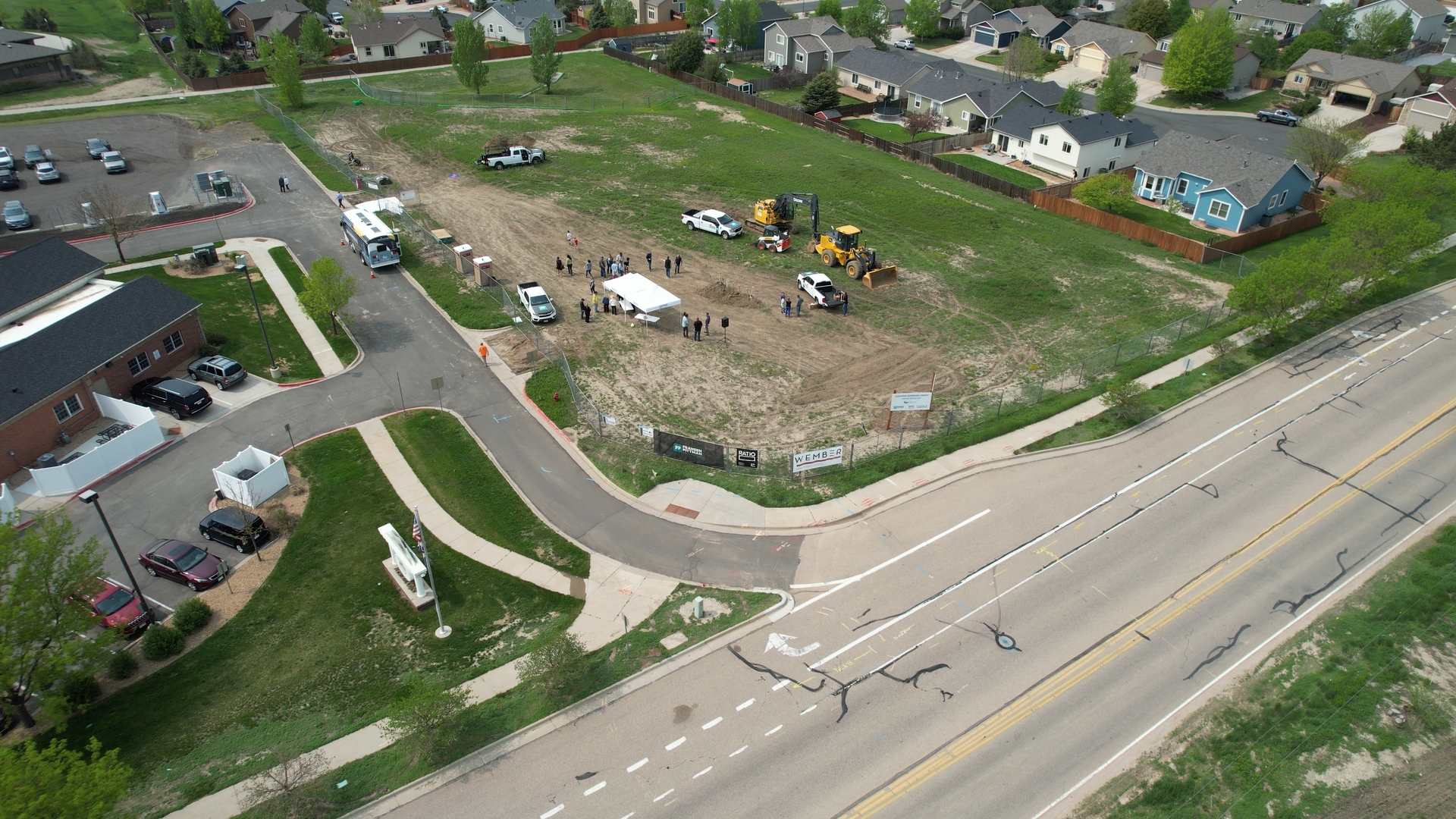
Severance Library
Pre-construction baseline documentation proved existing road damage before construction began. Split a massive change order in half.
Read the Story →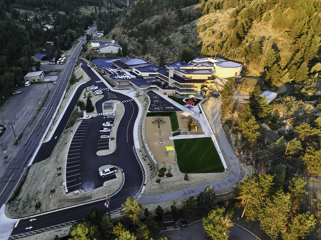
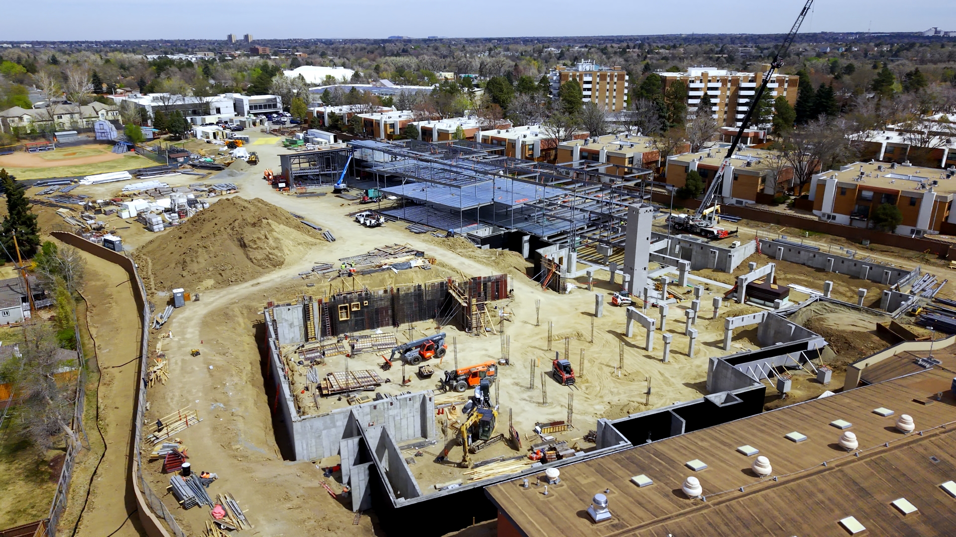
Clear Creek Schools
Interior documentation proved the building was empty when copper went missing. The GC absorbed the $400K change order.
Read the Story →The $24 Million Project — Severance, CO
16 months of progress monitoring. Bi-weekly flights ensure a perfect timeline and total budget accountability.
See the Timeline →From Flight to Data in 24–48 Hours
Mission Planning
We coordinate with your superintendent, handle airspace clearances, and plan flight paths that capture critical data without disrupting work.
Data Collection
Part 107 certified pilots. All PPE, safety protocols, and FAA compliance handled. We manage NOTAMs and LAANC so you don't have to.
Processing & Delivery
Ortho maps, 3D point clouds, and timeline comparisons. Full compatibility with Procore, Autodesk, and your VDC workflow.
Frequently Asked Questions
Everything you need to know about drone intelligence for your project.
How accurate are drone volumetric analysis tools?
Our analysis provides decision-grade accuracy suitable for earthwork billing and cut/fill calculations. We deliver high-precision data that settles disputes and prevents material over-ordering.
What deliverables do you provide?
We provide high-resolution orthomosaics, 3D point clouds, digital elevation models, and volumetric calculations. All files are formatted for seamless integration with Procore, Autodesk, and CAD workflows.
What is the turnaround time?
Standard turnaround is 24–48 hours from flight to delivered data. We prioritize rapid delivery so your team can make decisions based on current site conditions.
Are you FAA licensed and insured?
Yes. All pilots hold FAA Part 107 Remote Pilot Certificates. We handle all airspace authorizations (LAANC), NOTAMs, and carry full commercial insurance required for industrial sites.
Stop Guessing. Start Documenting.
One avoided change order pays for years of drone services. Don't wait for the dispute to wish you had the metadata.
Get a Project Quote